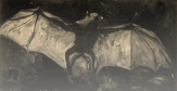
Flying-foxes provide essential ecosystem services through pollination, but are increasingly threatened by habitat loss, as exemplified by Australia’s 2019/2020 megafires. Quantifying flying-fox foraging resources in space and time via eucalypt flowering mapping would provide a powerful tool for identifying spatially explicit targets for habitat conservation and rehabilitation, to benefit the vulnerable grey-headed flying-fox as well as other nectarivores, along with the trees they service. Important recent advances in drone technologies and the spatiotemporal resolution and availability of satellite imagery now provide the opportunity to develop high-resolution eucalypt flowering maps at the landscape scale.
We intend to capitalize on these recent technological advances to map the spatiotemporal dynamics of eucalypt flowering across eastern Australia. Importantly, we will use our existing flying-fox tracking work and radar monitoring data to validate our remote-sensed eucalypt flowering maps, something that has not been achieved previously.
AIM: The aim of this project is to generate remote-sensed eucalypt flowering maps, validated by the observed presence of foraging flying-foxes, at landscape scales.
OUTCOMES: The project will provide accurate estimates of the amount of nectar resources lost due to Australia’s 2019-20 megafires, and provide spatially explicit targets for conservation and restoration. The benefits of this project extend beyond flying-foxes to other threatened nectarivores as well as economic assets that rely on Australia’s dwindling nectar supplies.
TEAM: Team: Prof Justin Welbergen (WSU), Dr Jessica Meade (WSU), Prof Matthias Boer (WSU); Dr John Martin (Ecosure); Sienna Grady (WSU)
|
STUDENTS: This work forms the basis of Sienna Grady's current PhD project, entitled "Monitoring the spatiotemporal dynamics of nectar availability for the grey-headed flying-fox across eastern Australia"
|
PARTNERS: David Westcott & Adam McKeown (CSIRO); with state-level representatives: NSW: Matthew Mo; Qld: Lindsey Delzoppo; Vic: Lachlan Clarke; ACT: Renee Brawata; SA: Jason van Weenen.
FUNDING: Regional Bushfire Recovery for Multiregional Species and Strategic Projects Program (2022-24); Western Sydney University (ongoing)